Outdoor Navigation

THE CHALLENGE

Reliable autonomy in complex,
unpredictable environments.

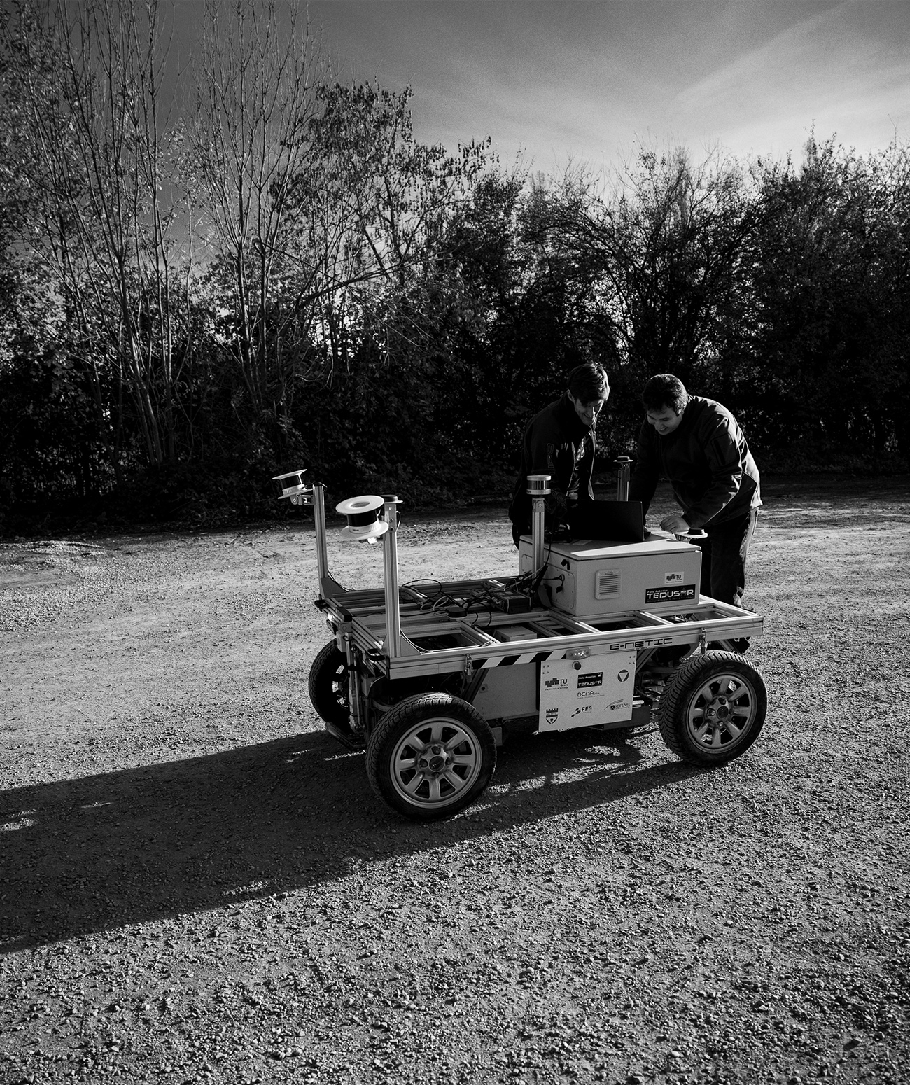
Outdoor navigation brings a new level of complexity: changing weather, uneven terrain, fluctuating signals, and dynamic obstacles require systems that can operate reliably under unpredictable conditions. Success in such settings requires systems that can adapt robustly and handle uncertainty in real time.


ARTI Outdoor Navigation Suite (AVI) is designed to meet these challenges head-on. By combining satellite positioning, advanced mapping, and real-time sensor fusion, it enables precise, robust navigation across large-scale and unstructured environments.

Sensors/Data Sources

GNSS


GPS


LIDAR (Ouster, Velodyne, SICK, …)


Depth Camera (Intel Realsense, Azure Kinect, …)


Inertial Measurement Units


Odometry


Radar


Ultrasound/Sonar


RTK Correction Data

Vehicles

ROS Robotic Platforms


Ackermann Steering


Differential Steering


Omnidirectional Designs


Various locomotion systems (e.g. wheels, tracks, legs)

Interfaces

VDA5050


Web Application (GUI) 


ROS 1 and ROS 2


Modbus


CANopen

Complete outdoor navigation suite


Large operating areas and off-road domains


Support for different drive mechanics

Localization AI Kit (WAI) included


Expandability of sensors


Weather resilience


Fleet management (VDA5050) available


Interface to Mapping/SLAM (JMI) available

What's included

Dynamic Mapping
Obstacle Avoidance
VDA5050
Dynamic Path Planning
Fine Positioning
Object Detection
Action Pipeline
System Diagnose
Web Application

Videos

Frequently Asked Questions

Does the system support GNSS/RTK for precise outdoor positioning?

Yes. The navigation platform can integrate external GNSS receivers (including RTK correction data) to achieve centimeter-level positioning accuracy outdoors.

How does the system handle GPS outages or weak-signal areas?

When GNSS signals are lost, it seamlessly switches to SLAM and IMU-based localization to maintain continuous path planning.

What accuracy can I expect for outdoor positioning?

With GNSS-RTK, typical accuracy is xyz < 20 mm; without RTK, 0.5–2 m. Fusion with additional sensors keeps overall deviation below 10 cm.

How robust is the system against environmental factors (rain, dust, temperature extremes)?

The software is designed to be very robust and adaptable to different and also challenging environmental conditions.

How does the system perform on varying surfaces (gravel, grass, asphalt)?

The software can be adjusted to master challenging environmental conditions which also includes terrain.

Are there safety features for unexpected obstacles outdoors?

Obstacle detection triggers emergency braking and avoidance maneuvers; configurable safety zones and collision alerts enhance operational safety.

Can weather data be integrated into route planning?

Yes. Connected weather-service APIs allow dynamic route adjustments based on rain, wind speed, and visibility.

Are geofencing features available?

Yes. You can define designated working and no-go areas, which restrict the robot’s or vehicle’s operating area.

Is there an offline map mode for remote deployment?

Yes. Map data can be downloaded and stored locally to ensure full navigation capability without network connectivity.

Partners

Hawe Hydraulik Logo

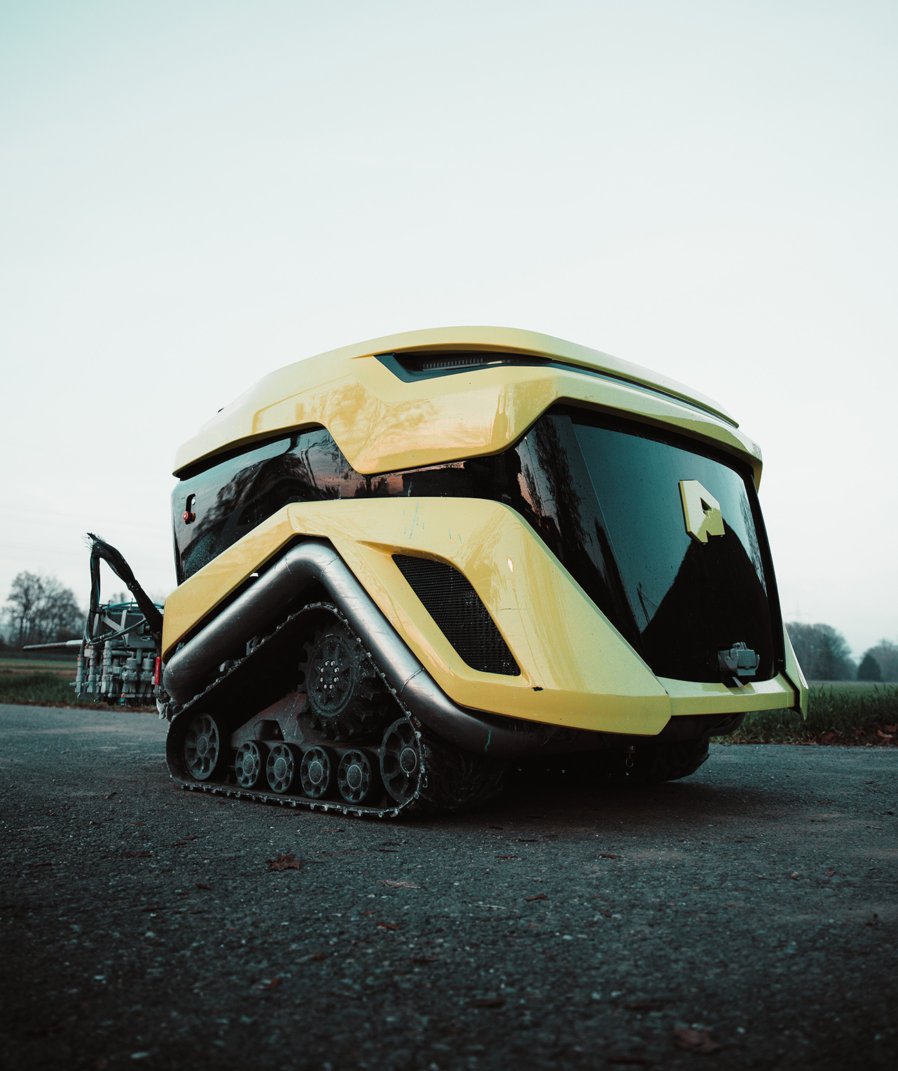
HAWE Hydraulik – ROVO

The ROVO robot platform is a fully electric, tracked drive system that has been specially developed for demanding off-highway applications. The agile chassis combines a powerful drive with the in-house exchangeable battery.

Thanks to its sophisticated and powerful technology, the ROVO can reach speeds of up to 30 km/h and a payload of up to 500 kg. Standardized interfaces enable flexible integration of a wide range of superstructures and applications.

LETS COLLABORATE

Send us an Email
to discuss a new project

Back

We use cookies to give you the best experience. Cookie Policy